What Is Orthomosaic Mapping?
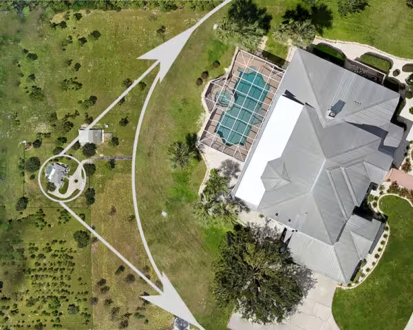
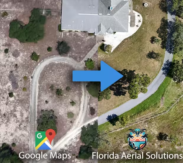
An orthomosaic map is like having a custom section of Google Earth, but with much higher resolution and having the images taken when you want. It’s a large, map-quality image created by stitching together many smaller images called orthophotos. The resolution of our orthomosaic maps are typically 5-10x that of Google Maps, and also have the advantage of being up-to-date.
Watch the video for a direct comparison between Google Maps and Florida Aerial Solutions’ orthomosaic technology solutions

Zoom in anywhere and always have a top-down, high-res orthogonal view of objects and terrain
Who Uses Orthomosaic Maps and Why?
- Land Developers and Real Estate Agents:
- Updated Views: Whether you’re planning a new development, assessing property, or evaluating land for investment, orthomosaics provide up-to-date views of large areas. Google Earth is helpful, but its imagery can be outdated.
- Property Assessment: Real estate agents use orthomosaics to determine if a property fits their clients’ needs.
- Construction Firms:
- Site Monitoring: Construction sites change rapidly. Orthomosaics offer regular, accurate views of construction progress. They’re like time-lapse photos with measurement capabilities.
- Precise Measurements: Construction firms use orthomosaics to measure distances, areas, and volumes. Software tools allow them to calculate stockpile volumes and estimate material costs without physically being on-site.
- Environmental Monitoring and Conservation:
- Vegetation Changes: Orthomosaics help track changes in vegetation cover over time.
- Invasive Species Detection: They’re used to identify encroachment by invasive plants.
- Soil Erosion Patterns: Orthomosaics reveal erosion patterns and landscape shifts.
- Farmers and Agriculture Specialists:
- Crop Health Monitoring: Orthomosaics help monitor crop health and optimize irrigation.
- Precision Farming: Farmers use them for targeted interventions based on vegetation indices.
- Archaeologists:
- Site Documentation: Orthomosaics preserve archaeological sites and cultural heritage.
- Change Detection: They reveal alterations in historical landscapes.

Compare the “current” Google Maps image with our up-to-date map scan
