Over the years, the FAA has refined it’s drone-specific rules and requirements, but one very crucial constant has remained very relevant for Realtors:
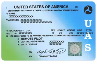
If a drone is used for commercial purposes, the operator must be FAA licensed.
What Are “Commercial Purposes”?
This could be anything from using a drone to attach a rope to a tree for a tree trimming company, inspecting powerlines, or taking pictures/video that are used to generate money in any way. Using pictures or video in a real estate listing that were taken from a drone is a commercial purpose and requires that the operator of that drone be licensed. Ignoring this rule has severe penalties for both the drone operator and the individual who hired/directed them to obtain the pictures.

What Does “FAA licensed” Mean?
For our purposes and not getting into super-heavy agricultural, industrial, or delivery drones, FAA licensed means obtaining a Remote Pilot Certificate with Part 107 licensing.
Being eligible for licensing involves several personal requirements involving age, citizenship, English language proficiency, and lack of criminal record. Then there is a lengthy written exam which involves flight map understanding, aeronautics, and safety information. If you have a private pilot’s license, this should all be very familiar. Additionally there are about $170 in fees associated with the licensing.
If you are interested in acquiring a Remote Pilot Certification, Drone U offers information and courses to be able to pass the FAA exam. Their Part 107 Study Guide is invaluable study material.
What Are These “Severe Penalties”?
Currently the FAA is fining unlicensed drone operators $1,100, and the individual who hired them $11,000.
This assumes there was no property damage, interruption of airspace, or crashes all of which may carry additional fines and criminal prosecution. These fines are “per flight” as well which means that if a Realtor, operating without an FAA license, had taken their own drone to several listings for photographs, piloted it themselves, and proceeded to post the photos on MLS, it would end up being $12,100 every time the drone left the ground. Goodbye commissions.

So you have decided to let someone else take the listing’s pictures. That’s probably a good option so you can avoid the headaches of FAA licensing and the risks with flying a drone around trees, powerlines, and controlled airspace. Before you hire someone, ensure they are FAA licensed. The bulk of the penalties ($11,000) will fall on you, not the drone operator if they end up not being licensed.
The FAA won’t just look at one of your listings, but every single listing from your company they can access. You will have to account for every aerial photo that you have ever posted.
The highest drone-related fine that was publicly stated by the FAA to date was in excess of $300,000 when they conducted an audit on a real estate company.
Florida-Specific Drone Laws
Generally, Florida has few restrictions on drone usage, but there is a law in place which covers generalized misuse of drones:
Chapter 934 Section 50: This statute prohibits the use of drones for unauthorized surveillance, voyeurism, harassment, reckless endangerment, property damage, or other illegal acts.
What does this mean for you? Don’t intentionally follow people around with a drone to scare them or take pictures of them. If someone happens to be in your photos or videos, that likely isn’t in violation of the law. If they are in public, there is no expectation of privacy. Keep in mind, this is not legal advice and you should consult an attorney for clarification if you plan on photographing people in public or private.
Additional Florida Restrictions Involve:
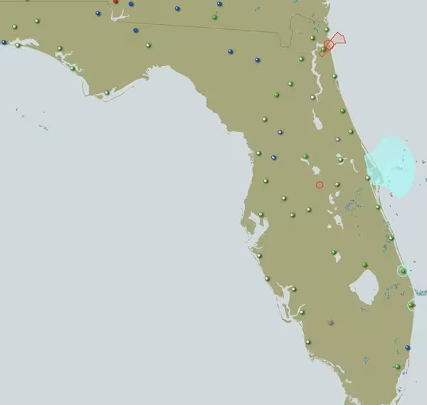
Not flying near Cape Canaveral or Kennedy Space Force installations within 24 hours of a launch
No flying in managed lands like state forests
Restricted access to flying in the Florida Keys
No flying around Disney – this has a permanent flight restriction in place
No flying around Mar-a-Lago – Trump’s residence has a permanent flight restriction in place which is approximately a 1 mile radius.
Additionally, there are federal restrictions to flying in national parks which includes the Everglades National Park.

Things to Keep in Mind
Always check for temporary flight restrictions and the weather before launching a drone. You can utilize many resources for this such as https://www.1800wxbrief.com . These change all the time and if you want to avoid heavy fines, possible imprisonment, and losing a drone, be sure to make this a habit. Always be aware of any airports in the area as well because there are runway corridors which are controlled airspace with very low flying aircraft. Lastly, keep an eye out for any other aircraft in the area, specifically helicopters since they frequently can be found within the operating ceiling of drones. You are obligated to get out of the airspace if another aircraft is in proximity.
Is There Any Good News?
Some recent changes in drone laws has done away with restrictions of flying over people and vehicles. Additionally, night flights are now permitted assuming the drone has an anti-collision light. The FAA has also worked to create useful online tools such as the B4UFLY app which shows restricted airspace and locations where takeoff is not permitted.
Where to Go From Here
If this licensing requirement is completely new to you and you have existing aerial images in violation of federal law, they should immediately be removed from MLS and anywhere else they are uploaded. Any drone images that have questionable origins should also be removed until you can verify your photographer is FAA licensed. Additionally, you should begin keeping records of who took what set of photographs, when, and retain a copy of their FAA Remote Pilot license. This is not legal advice, always consult with an attorney for clarification.
Florida Aerial Solutions can provide proof of licensing while handling all your aerial photography needs. We also offer videography services, editing, and posting to YouTube as well. A basic package consisting of exterior drone still images and a video of an orbit of the property starts at $300. Additionally we have the capability to do Steadycam video walkthroughs of a property and Zillow 3D Home scanning of interiors. If you have a really large property, we can also do orthomosaic mapping which is like having a super high-resolution Google Map satellite view. Contact us to schedule a consultation.

