Drone photography is revolutionizing Florida’s wildlife conservation efforts by offering new perspectives for monitoring ecosystems. This technology provides advantages in surveying diverse habitats while minimizing human impact. In this article, we explore the role of drones in conservation, focusing on their benefits and applications in Florida’s unique environmental landscape.
The Role of Drones in Wildlife Monitoring
Drones have become an essential tool in the arsenal of wildlife conservationists, providing unique insights into understanding and protecting Florida’s rich biodiversity. Their ability to cover vast areas quickly, while capturing detailed aerial imagery, affords conservationists a strategic advantage in monitoring wildlife populations and their habitats.
One of the most significant contributions of drones lies in their capacity to map terrain. High-resolution aerial images allow researchers to gather critical baseline data, including vegetation cover, land use, and habitat fragmentation. This information can highlight areas in need of protection or restoration and inform conservation planning efforts. For example, drone-assisted terrain mapping has proven invaluable in tracking the declining habitats of the Florida panther, a species at risk of extinction. By identifying patterns in land use changes over time, conservationists can better strategize efforts to maximize the success of conservation initiatives.
Furthermore, drone photography enhances the ability to track animal populations. The Florida Fish and Wildlife Conservation Commission (FWC) has employed drones in surveys of manatee populations, especially during the winter months when these marine mammals congregate in warmer waters. Drones can provide accurate counts and assess the distribution of manatees without the need for intrusive methods, yielding critical insight into population dynamics and informing conservation strategies that protect their habitats. This non-invasive monitoring technique is crucial not only for identifying population trends but also for detecting changes in behavior due to environmental pressures or human disturbances.
Monitoring behavioral patterns over time is another area where drones shine. For instance, in the conservation of sea turtles, drones are utilized to monitor nesting sites along Florida’s coastline. These aerial systems can observe nesting activities and track hatchling movements while minimizing disturbances to both the adult turtles and their nests. By observing these sites from the air, researchers can gather data on nesting success rates, assess the impact of environmental factors, and determine the effectiveness of conservation measures aimed at protecting this species.
Within the framework of successful conservation initiatives, case studies abound illustrating the effectiveness of drone technology. The use of drones to monitor the population dynamics of endangered species like the Florida scrub-jay has provided insights into habitat selection and reproductive success, enabling targeted conservation efforts. These innovative approaches are poised to expand as more conservationists adopt drone technology.
In summary, the integration of drone photography into wildlife monitoring has profoundly enhanced Florida’s conservation strategies. With their ability to provide comprehensive and high-resolution insights, drones are paving the way for informed decision-making and effective management of Florida’s unique ecosystems. As conservationists continue to explore these technologies, the potential for innovation in protecting biodiversity remains vast and promising.
Integrating Drone Technology into Conservation Strategies
The integration of drone technology into conservation strategies enhances the efficiency and effectiveness of resource management. In Florida, the Florida Fish and Wildlife Conservation Commission (FWC) utilizes drones to augment traditional conservation methods. Drones serve as a pivotal component of broader conservation frameworks that involve collaboration between governmental bodies, non-profits, and research institutions. The synergy created through these partnerships enables stakeholders to pool resources, share expertise, and generate innovative solutions to pressing conservation challenges.
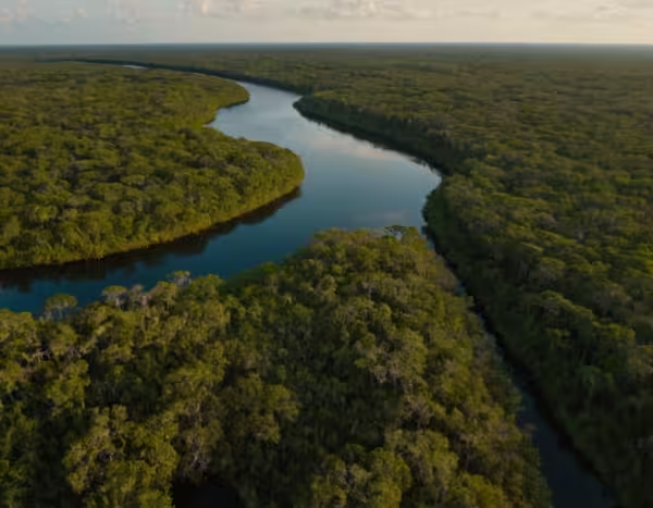
Drone technology is particularly valuable in habitat restoration projects. For example, the reforestation of mangroves—critical ecosystems that provide habitat for diverse wildlife and act as natural buffers against storm surges—has benefited greatly from drone-assisted monitoring. Drones equipped with advanced imaging technology can track the health and growth of newly planted mangroves, ensuring that restoration efforts are yielding desired outcomes. Furthermore, drones assist in identifying areas that require intervention due to invasive species growth. By employing aerial surveillance, conservationists can pinpoint dense infestations of non-native plants, enabling targeted removal efforts that restore the ecological balance.
Challenges persist in the incorporation of drone technology into conservation initiatives. Regulatory issues often pose significant hurdles. The FAA regulates drone usage, necessitating compliance with strict guidelines that can limit operational flexibility. Additionally, the requirement for certified drone operators adds another layer of complexity, particularly in remote areas where conservation efforts are frequently focused. This can impede the rapid response needed in dynamic environments, such as during wildlife emergencies or natural disasters.
Another challenge involves the need for technical expertise. Effective drone deployment requires skilled personnel who can operate the equipment and analyze data collected accurately. Building a workforce proficient in drone usage and data interpretation is essential for maximizing the technology’s benefits in conservation work. Training programs and partnerships with educational institutions can help bridge this skills gap, fostering a new generation of conservationists adept at using these innovative tools.
Despite these challenges, the future of drone applications in conservation work presents exciting opportunities. With advancements in drone technology, the potential for more sophisticated data collection methodologies and analysis techniques is on the horizon. Enhanced AI algorithms could allow drones to autonomously conduct complex monitoring tasks, gathering data on wildlife populations, environmental health, and habitat conditions in real time.
Moreover, integrating drones with other technologies, such as satellite imagery and ground-based sensors, can create a multifaceted approach to conservation that ensures robust data gathering and analysis. Collaborative efforts among governmental agencies, non-profits, and research institutions can lead to comprehensive projects that leverage the strengths of each organization. Through commitment to innovation and continual adaptation of technology, drone photography will remain a transformative tool for wildlife conservation in Florida, ultimately making strides toward protecting and restoring biodiversity.
Conclusions
Drone photography significantly contributes to the advancement of wildlife conservation in Florida by providing detailed, non-intrusive insights into ecological dynamics. As we have explored, drones enhance monitoring capabilities and facilitate integrated resource management strategies. The ongoing innovation in drone technology promises even greater contributions towards preserving Florida’s rich biodiversity, highlighting a critical evolution in conservation methodologies.

